Use Case 4: Improved Soil Management for Intensive Potato Farming in the Netherlands
Overview:
We will focus on improving soil management and profitability for potato farming in the Reusel region of the Netherlands, where sandy soils have high variability in soil organic content (SOC). Potato farmers, like the van den Borne farm (500 ha), face challenges in optimizing crop density due to inconsistent soil conditions. By using advanced soil mapping and variable rate seeding technology, farmers can reduce the use of costly seeding material while improving yield. The SQAT system will enhance this process by providing a more affordable, accurate, and actionable soil map.
Challenges:
- High variability in SOC across fields.
- Shading and competition from nearby trees affect water and nutrient availability.
- Difficulties in optimizing crop density due to inconsistent soil conditions.
- Environmental regulations (e.g., Water Framework Directive) require precise nutrient management.
- Traditional soil mapping methods are costly and labour-intensive.
Smart Farming Applications involved:
- Variable-Rate Macronutrient Fertilization
- Variable-Rate seeding
Expected Outcomes:
- High-resolution soil maps that guide variable seeding and fertilization.
- Reduced nitrogen emissions and better nutrient management.
- Cost-effective, scalable soil mapping methods for improved soil health and crop yield.
- Increased farmer awareness of soil variability and the benefits of precision farming for potato cultivation.
Updates
In the Netherlands, SQAT partners VDBorne and AeroVision are working on improving soil management and profitability in intensive potato farming through high-precision soil analysis and variable-rate applications.
Combining satellite imagery and soil sensing
The SQAT workflow begins by using satellite imagery to identify soil zones within agricultural fields. These zones help determine the most effective locations for targeted soil sampling.
To validate and refine this approach, the project team mapped 45 fields using both:
- satellite-based Earth Observation data
- electromagnetic induction (EMI) sensors measuring soil conductivity
Within each field, 6 to 8 targeted soil samples were collected and analysed for key soil parameters including:
- soil pH
- organic matter content
The resulting dataset is now being used to optimise SQAT’s satellite-based zoning algorithms and improve the accuracy of digital soil mapping.
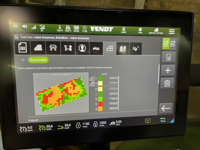
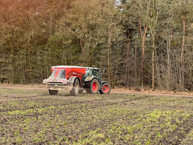
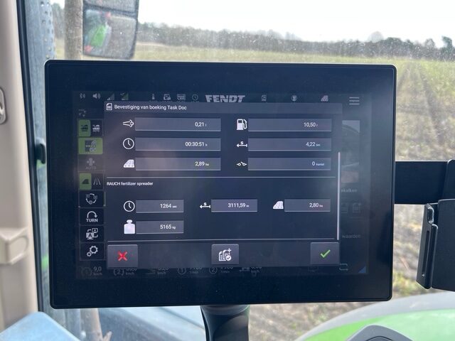
From mapping to variable-rate applications
The collected data were also translated into variable-rate application maps.
The team has already successfully implemented variable-rate liming on several fields, while variable-rate seeding and fertilisation are planned for later in the season.
This work demonstrates how combining satellite data with in-field sensing and soil analysis can support more precise agricultural management.
Why is this important?
Agricultural fields are rarely uniform. Managing fields based on average conditions can lead to inefficient input use and uneven crop performance.
By moving from whole-field management to zone-specific analysis, SQAT enables:
- more precise placement of nutrients and inputs
- improved resource efficiency
- better understanding of field variability
- more sustainable farming practices
The use case also contributes to building a valuable soil and management database that can support future analyses and decision-making tools within the project.